How will San Francisco transportation change in 2026? New routes, BART upgrades, road updates
Learn about San Francisco’s 2026 transportation changes, including new bus routes, BART upgrades, and road maintenance across the Bay Area.
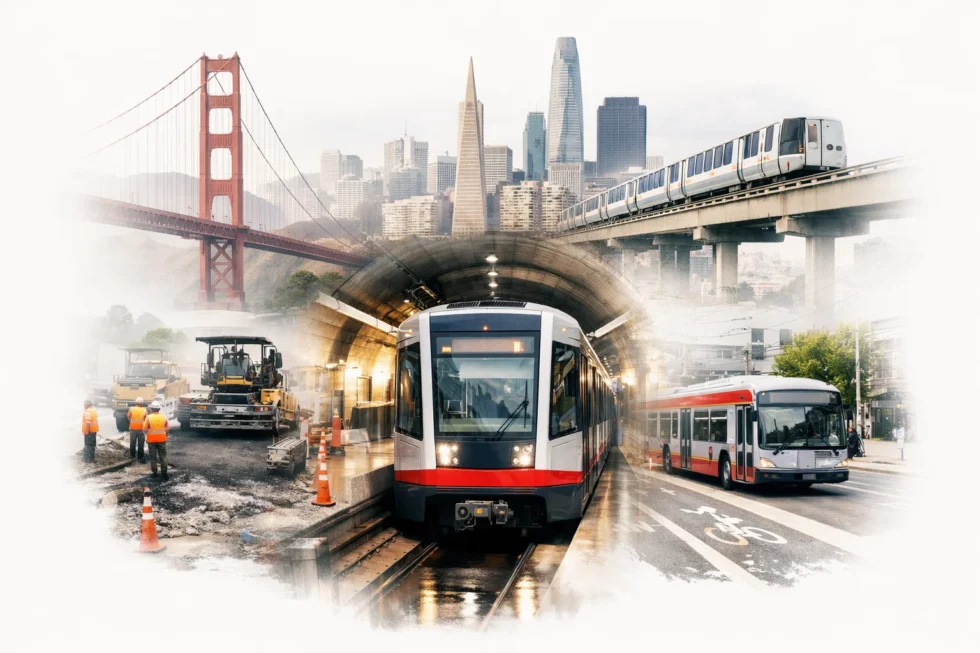
San Francisco’s transportation system is undergoing significant updates in 2026, affecting residents, commuters, and local businesses across the Bay Area. Key changes include the introduction of new bus and light rail routes, major road maintenance projects, and upgrades to the Bay Area Rapid Transit (BART) network. These adjustments aim to improve traffic flow, enhance safety, and accommodate increasing ridership in the city’s densest neighborhoods. For residents in areas such as the Mission District, SoMa, and the Richmond, understanding these updates is essential for daily commuting, scheduling, and planning alternative routes. Additionally, the city’s Department of Public Works is coordinating multiple road repairs that may impact peak travel times. Keeping track of these modifications is critical for avoiding delays and ensuring smooth navigation throughout San Francisco, reported by San Francisco Newsroom.
What is San Francisco Transportation Update and How It Works in San Francisco
The 2026 San Francisco transportation update encompasses multiple systems, including Muni buses and trains, BART services, and city streets. These updates are designed to reduce congestion, improve safety, and enhance accessibility for all commuters. New bus lines have been added in neighborhoods like Bayview-Hunters Point and the Outer Sunset to better connect residential areas with commercial centers. Metro and light rail renovations include station modernizations, track replacements, and improved signage to streamline passenger flow. Additionally, the city’s roadwork projects focus on resurfacing streets, upgrading crosswalks, and repairing aging infrastructure. Local transportation authorities coordinate construction schedules to minimize impact on peak hours, while digital alerts provide residents with real-time updates.
Example: Residents in Noe Valley now have faster access to downtown via the updated 24-line bus route, while Mission Bay commuters benefit from improved train frequency on the T-Third Muni line.
Transportation Features in San Francisco
| Feature | Details | San Francisco Notes |
|---|---|---|
| Muni Bus Updates | New routes and frequency adjustments | 24-line, 9-San Bruno, and 22-Fillmore enhanced |
| Light Rail Renovations | Station improvements, track replacement | T-Third and N-Judah lines prioritized |
| BART Network Upgrades | Signal modernization, station accessibility improvements | Emphasis on Embarcadero, Powell, and Daly City stations |
| Road Maintenance | Resurfacing, pothole repairs, crosswalk updates | Key streets include Market Street, Geary Blvd, and Van Ness |
| Real-time Alerts | Mobile notifications, digital signage | SFMTA and BART apps provide instant updates |
How San Francisco Transportation Updates Work in Real Life for Bay Area Residents
Bay Area residents can navigate these transportation changes by following practical steps. First, commuters should check the SFMTA website or mobile app for updated bus and light rail schedules. For example, the new 24-line bus route provides additional morning and evening trips, reducing wait times in the Mission District. Residents using BART should monitor planned station upgrades and temporary closures, especially at busy hubs like Embarcadero. Road repairs are scheduled in stages, with clear detours marked on-site. Daily commuters are encouraged to plan alternative routes in advance, particularly in neighborhoods experiencing construction on main arteries like Geary Boulevard. Employers in SoMa and downtown are coordinating staggered work hours to ease congestion, reflecting broader city efforts to maintain smooth travel across the Bay Area.
Practical Tips for Residents
- Confirm updated route schedules before travel
- Carry contactless payment cards for Muni and BART
- Use local traffic apps to monitor real-time delays
- Plan for alternate routes during road maintenance
- Consider early or late commuting times to avoid peak congestion
Real-Life Situations in San Francisco
In real scenarios, residents experience a mix of convenience and adjustment during transportation updates.
“Many Bay Area residents face this situation every year,” explains a local consultant. A commuter traveling from the Richmond District to downtown may find the N-Judah light rail temporarily rerouted due to track replacement. Similarly, road resurfacing along Van Ness Avenue can require detours that extend travel time by 10–15 minutes. Neighborhood residents in SoMa may notice increased bus frequency on new routes, but parking restrictions near construction zones can cause additional planning requirements. “Understanding the local rules is essential in San Francisco,” notes a community adviser. Staying informed through city apps and public notices helps minimize disruption while benefiting from improved transit infrastructure.
San Francisco Transit Options Comparison
| Option | Benefits | Limitations |
|---|---|---|
| Muni Bus | Flexible routes, frequent updates | Subject to traffic delays during peak hours |
| Light Rail | Faster than buses, reliable for central neighborhoods | Temporary closures during track maintenance |
| BART | High-speed regional access across Bay Area | Limited coverage in some neighborhoods |
| Car Sharing | Convenient for last-mile travel | Parking restrictions, fuel cost variability |
| Bicycle/Walking | Environmentally friendly, traffic-independent | Weather-dependent, limited distance coverage |
Common Mistakes San Francisco Residents Should Avoid
Residents often underestimate the impact of construction schedules and temporary route changes. Failing to check real-time updates before commuting can result in unnecessary delays. Another common mistake is assuming that all light rail lines operate at full speed during maintenance periods; track repairs may require slower travel or temporary detours. Ignoring signage for road closures or parking restrictions can lead to fines or vehicle towing, particularly in high-traffic neighborhoods like the Financial District. Additionally, relying solely on printed schedules instead of mobile apps may leave commuters unaware of last-minute changes. Planning ahead, using digital alerts, and monitoring neighborhood-specific updates are essential practices to avoid disruptions in San Francisco transportation.
Frequently Asked Questions
Q: What are the main updates in San Francisco transportation for 2026?
A: The updates include new bus routes, light rail renovations, BART signal improvements, and road maintenance projects across the city.
Q: How can I find real-time public transit information in San Francisco?
A: Use the SFMTA and BART mobile apps or check official websites for schedules, alerts, and detour notices.
Q: Are there temporary closures for roads in the Bay Area?
A: Yes, streets like Geary Boulevard and Van Ness Avenue have scheduled resurfacing and repairs. Digital alerts provide detour information.
Q: How do new bus and light rail routes affect daily commuting?
A: Updated routes reduce wait times, improve connectivity between neighborhoods, and provide alternative options during peak hours.
Q: What should I do if a BART station is temporarily closed?
A: Check alternate stations nearby, use bus or Muni connections, and follow city updates for reopening schedules.
San Francisco News keeps the city, the Bay Area and the wider world informed — with clear, useful reporting on what’s happening, where it matters and what people need to know across technology, business and public life. Read also: How to apply for a US visa in San Francisco in 2026 step by step guide